Sourced fact
The News
The United Nations has reported that the network of Israeli military checkpoints and barriers stretching across the occupied West Bank has reached 942 checkpoints, closures, and other obstacles, according to the latest data issued by the Committee on Settlements, Separation Wall, and the Office for the Coordination of Humanitarian Affairs. These new figures indicate a massive expansion of the system that separates cities and villages and prevents Palestinians from moving freely between their areas and agricultural lands.
The Hebron Governorate leads the list of governorates with the most restrictions, hosting 221 fixed checkpoints and closures, followed by Ramallah and Birzeit with 160 points, Nablus with 120, Jerusalem with 62, Jaffa, Bethlehem, and the Gaza Strip. Additionally, 13 new checkpoints were added in the past two months, including 10 in Jenin Governorate, which raised its fixed count from 16 to 26, plus the installation of a new gate on the Jariyut road west of Ramallah and another on rural roads.
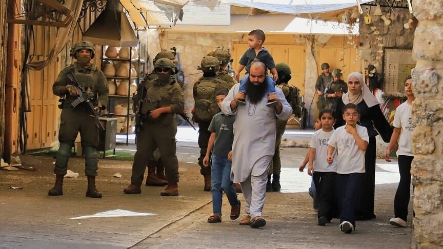
This system includes a complex network of iron gates that close village and city entrances and agricultural roads, along with earth mounds, trenches, and obstacles that cut across main and secondary roads. This web allows occupation forces to have full control over Palestinian movement between their workplaces, homes, and lands; closing a single gate can force residents to take long alternative routes or isolate entire areas for hours or days.
Data shows that this system represents an expansion of a network that began forming over two decades ago, where the number of barriers rose from 757 in 2003 to 942 points currently, with a gradual shift from temporary earth barriers to permanent gates and checkpoints increasing Israel's ability to control. These restrictions negatively affect Palestinian access to their agricultural lands, educational institutions, and health facilities, as military constraints intertwine with the Palestinian road network to lengthen distances between geographically close communities.
Analysis & context
Analysis & Context
From an analytical perspective, this expansion of the checkpoint network represents a strategic shift from temporary barriers to permanent infrastructure for geographic control, reinforcing the concept of "separation" that resembles dividing the West Bank into isolated regions akin to provinces. This model allows Israeli forces to dismantle Palestinian social and economic fabric without needing to declare a state of war each time.
In a broader context, historical data indicates that this network did not develop randomly but was part of a deliberate plan starting in 2003 to divide the West Bank, where the number of barriers steadily increased over the years to reach its current peak. This trend reflects a shift in occupation policies toward marginalizing Palestinian areas and transforming them into isolated islands entirely dependent on permission from the occupier to pass through specific points.
This system directly affects Palestinian livelihoods by preventing regular access to agricultural lands and reducing farmers' productivity, while disrupting the movement of students, patients, and workers between their regions and essential service centers. These restrictions are part of a comprehensive policy aimed at eroding Palestinians' economic and social capabilities in the long term.
Finally, the interconnected nature of this network means that closing a single point can lead to isolating an entire area or turning a short journey into a complex route passing through multiple control points, deepening the isolation experienced by residents in their various regions.